Wednesday’s weather: Cloudy and cool, possible shower, high of 64
Get ready for a day of cloudy skies and cool temperatures, with a brief shower expected. The mercury will climb to a high of 64 degrees.
Weather Watch with Rick Gordon
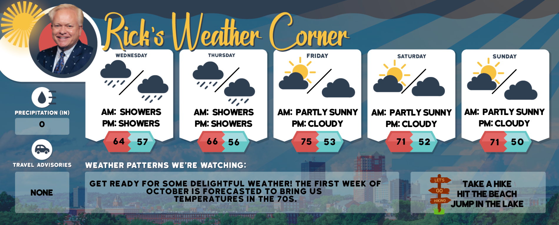
Wednesday’s weather
Get ready for a day of cloudy skies and cool temperatures, with a brief shower expected. The mercury will climb to a high of 64 degrees.
Outlook for Sept. 25-29
Today: Cloudy and cool with a brief shower. High 64 Winds: E 5-10 mph
Tonight: Expect periods of showers with a total of 0.18 inches of rain later at night. Low 57 Winds: Light & Variable
Thursday: Cloudy and cool with intermittent showers, accumulating up to 0.30 inches, and a possible thundershower. High 66 Winds: SSW 5-10 mph
Thursday night: Showers early with some clearing late. Low 56 Winds: Light & Variable
Friday: Warmer with a mix of sun & clouds. High 75 Winds: NNW 5-10 mph
Friday night: Partly cloudy. Low 53 Winds: Light & Variable
Saturday: Nice with a mix of sun & clouds. High 71 Winds: Light & Variable
Saturday night: Partly cloudy Low 52 Winds: Light & Variable
Sunday: Some sun & clouds. High 71 Winds: Light & Variable
Sunday night: Few clouds. Low 50 Winds: Light & Variable
Hurricane Watch
Hurricane Watch A tropical rainstorm in the western Caribbean has intensified into Tropical Storm Helene, marking the eighth named storm of the 2024 Atlantic hurricane season. The storm’s center is approximately 600 miles south of Tampa and is anticipated to veer northward. It is projected to navigate through the channel between Cuba and Mexico’s Yucatan Peninsula before entering the Gulf of Mexico, where it is expected to escalate rapidly into a major hurricane. A hurricane is expected to make landfall as a major Category 3 storm, with wind speeds between 111-129 mph, according to the Saffir-Simpson Hurricane Wind Scale. Current projections suggest the highest landfall probability along the Florida Panhandle coast Thursday evening.

Weather Patterns We’re Watching
Get ready for some delightful weather! The first week of October is forecasted to bring us temperatures in the 70s.
Hiking Forecast
Take a Hike
Elevations for summits above 4,000 feet in Northern New Hampshire today: In the morning, summits will appear and disappear among the clouds, later becoming obscured, with highs in the mid-40s. Expect southeast winds of 10 to 15 mph, gusting up to 30 mph.
Elevations between 2,500 and 4,000 feet in Northern New Hampshire today: Peaks will be shrouded in and emerging from clouds, with temperatures reaching the lower 50s. Expect southeast winds at 10 to 15 mph, gusting up to 30 mph.
Peak Foliage Tracker
The optimal period for viewing fall foliage ranges from late September to October, with popular spots likely filling up quickly. To avoid the crowds, visiting parks and hiking trails early in the day is recommended.

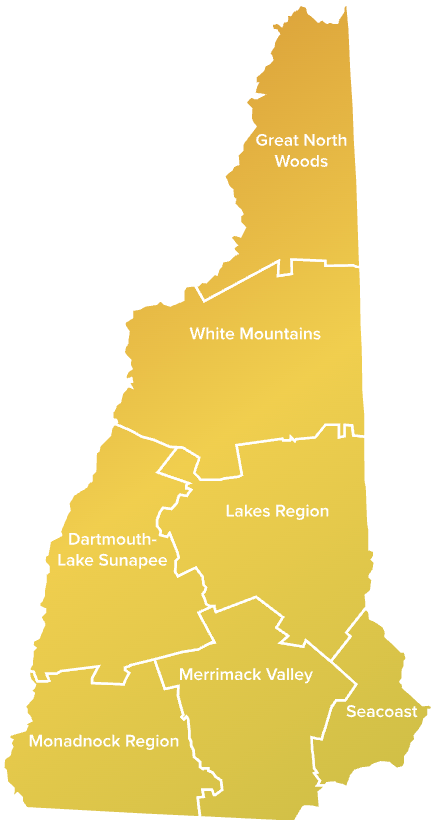
Click here to go to the Visit NH Fall Foliage interactive tracking page


