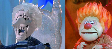
Weather alert: Snow Miser coming, followed by Heat Miser
It’s going to be freezing cold and then (relatively) hot.

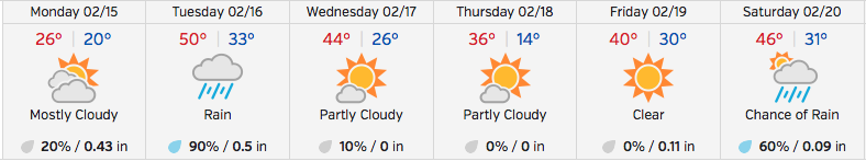
MANCHESTER, NH – We’re in the midst of February’s deep freeze. Pipes are bursting, oil heaters are guzzling, frostbite is a real and present danger. Overnight sub-zero temperatures Sunday will be followed by more seasonal temperatures, in the mid-20s and a good chance of more precipitation Monday night.
And then Tuesday, a high of 50 degrees on Tuesday.
Say what?
Yes, according to the Weather Underground, a winter weather advisory remains in effect from 5 p.m. Monday to 10 a.m. Tuesday, with snow changing to freezing rain or sleet which may cause hazardous travel Monday night.
Accumulations of up to six inches of snow and up to a tenth of an inch of ice possible. Snow will begin in southern New Hampshire around the time of the evening commute on Monday and continue through the evening, changing to freezing rain or sleet after midnight and eventually just rain Tuesday morning.
High expected to be about 50 degrees.
Temperatures will remain on the higher through next weekend.