
Tuesday’s weather: Patchy fog to start, then hot and humid with sunshine, high of 90
Early patches of fog will dissipate, leading to mostly sunny conditions that will grow hotter and more humid. The high will be 90 degrees, feeling like 93.

Weather Watch with Rick Gordon
Click below for Rick’s exclusive videocast.
Tuesday’s Weather
Warm Up/Cool Down
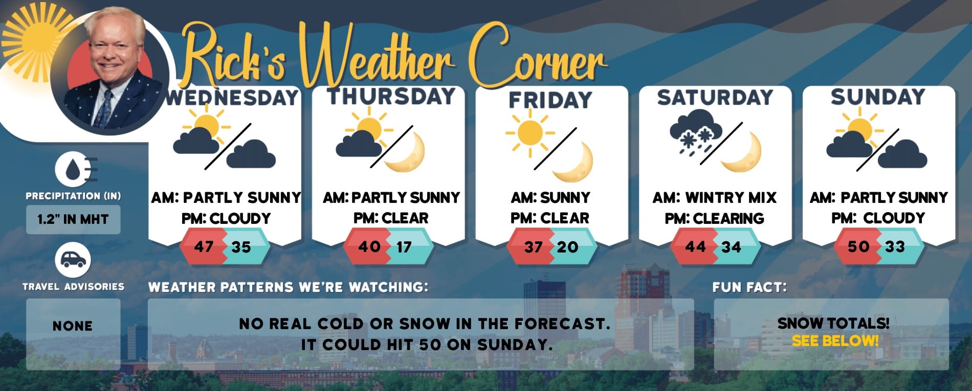
Expect summer-like heat and humidity today through Wednesday, with a cold front likely to bring strong thunderstorms on Thursday. The weather should dry out and return to seasonal averages in time for the Memorial Day weekend.
5-Day Outlook, May 21-25Today: Early areas of patchy fog will give way to mostly sunny skies, with conditions becoming hotter and more humid. High 90 (feel like 93) Winds: SSW 5-15 mphTonight: Mainly clear, mild, and humid. Low 65 Winds: SSW 5-10 mphWednesday: Hot and humid with some sun. High 92 (feel like 95) Winds: SSW 5-15 mphWednesday night: Partly cloudy, quite mild, and humid. Low 65 Winds: SW 5-15 mphThursday: Expect a very warm day with intermittent sunshine, followed by a severe afternoon thunderstorm. These thunderstorms may lead to flooding downpours, hail, and potentially damaging wind gusts. High 87 (feel like 90) Winds: WSW 10-15+ mphThursday night: Some clouds and less humidity. Low 62 Winds: W 5-10 mphFriday: Mostly sunny, breezy and pleasant. High 83 Winds: WNW 10-15 mphFriday night: Clear. Low 54 Winds: WNW 5-10 mphSaturday: Mostly sunny & nice. High 79 Winds: NW 5-10 mphSaturday night: Mainly clear. Low 53 Winds: Light & Variable
Weather Patterns We’re WatchingThe initial forecast for Memorial Day weekend indicates dry conditions with sunshine and high temperatures in the 70s. On Memorial Day, expect variable clouds with the possibility of a few showers by evening.

Hiking Report/White Mountains Weather
Elevations for summits above 4,000 feet in Northern New Hampshire Today: The forecast is mostly cloudy with highs in the lower 70s, except for mid-60s at elevations above 5000 feet. Expect west winds of 10 to 20 mph, with gusts up to 35 mph.Elevations between 2,500 and 4,000 feet in Northern New Hampshire Today: The forecast is mostly cloudy with a possibility of afternoon showers. Temperatures will reach the mid-70s. Expect west winds at 10 to 15 mph, gusting up to 35 mph. There’s a 30 percent chance of rain.
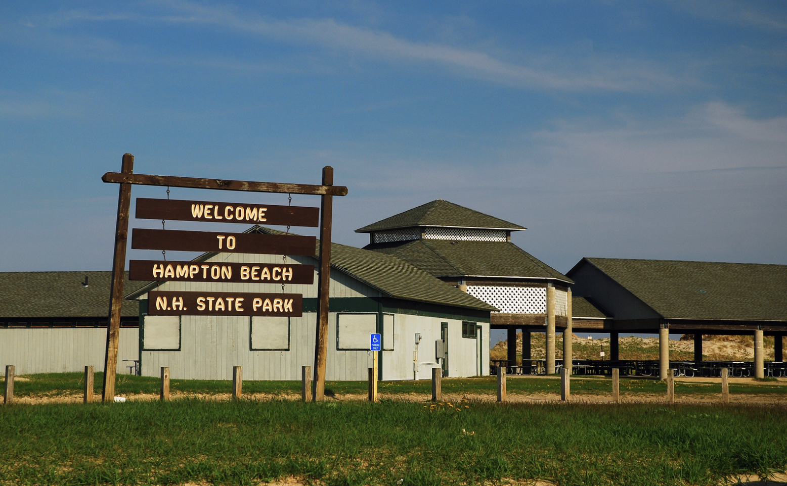
Beach Forecast
Weather: Mostly sunny.
UV Index: Very High.
Thunderstorm Potential: None.
High Temperature: In the lower 70s.
Winds: South winds 5 to 10 mph.
Surf Height: Around 3 feet.
Rip Current Risk: Low.
Water Temperature: 53 degrees. The US Coast Guard advises that if the water temperature falls below 60 degrees, an average person immersed in water may experience loss of dexterity within minutes, rendering them incapable of performing simple tasks such as fastening a life jacket or using a radio.
Tides Hampton Beach: High tide of 7.7 feet (MLLW) at 10:53 AM. Low tide of 1.2 feet (MLLW) at 5:02 PM.
Lake Forecast

Southwest winds will be blowing at 5 to 10 mph, with wave heights around 1 foot. The weather will be mostly sunny with high temperatures around 80 degrees. Thunderstorms are not expected during this period. The water temperature is currently 58 degrees. The US Coast Guard states that if the water temperature falls below 60 degrees, an average person submerged in such conditions may experience a loss of dexterity within minutes, rendering them incapable of performing simple tasks such as fastening a life jacket or using a radio.