Snow’s coming: Stock up on bread and milk, MST open house canceled
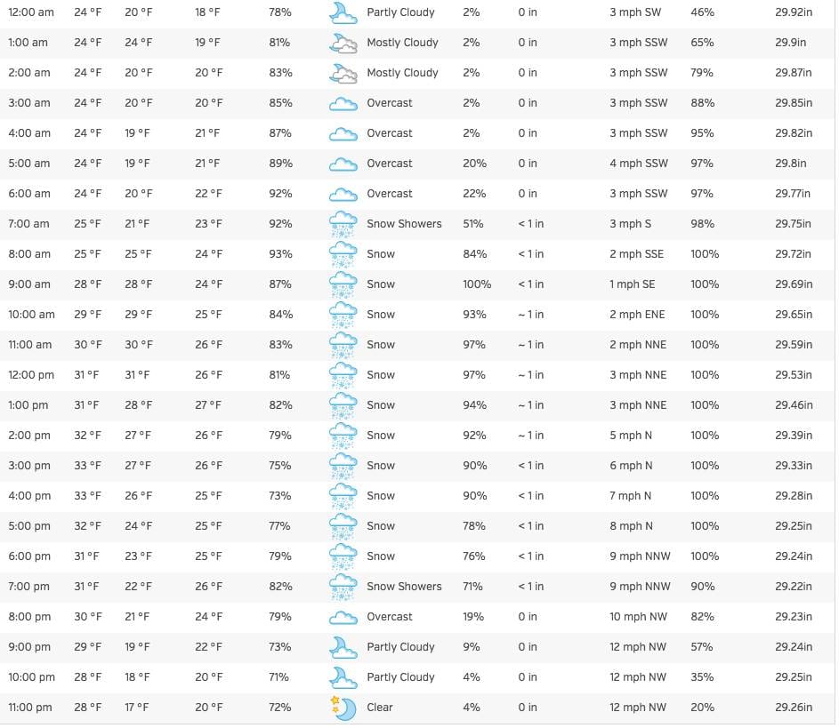
Finally, it will feel like winter in New Hampshire. As always, make sure you get the obligatory bread and milk today, and plan to stay home during the height of the storm, which will be between 9 a.m. and 7 p.m., according to the handy chart above via The Weather Underground.
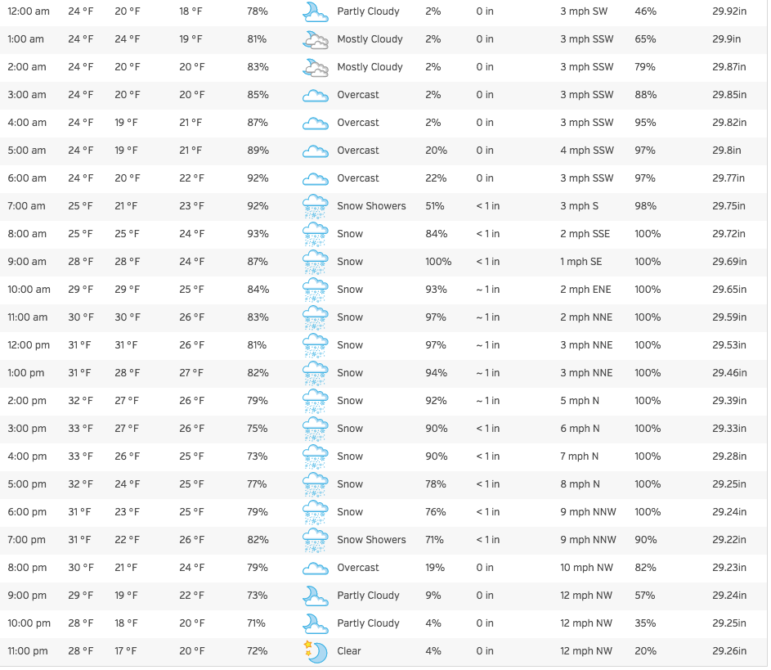
MANCHESTER, NH – There’s a Winter Storm Watch in effect from late tonight, Jan. 23, through Saturday evening, according to the National Weather Service out of Gray, Maine, for Hillsborough County and surrounding towns.
Finally, it will feel like winter in New Hampshire. As always, make sure you get the obligatory bread and milk today, and plan to stay home during the height of the storm, which will be between 9 a.m. and 7 p.m., according to the handy chart above via The Weather Underground.
One postponed event so far: The Jan. 24 Open House scheduled for the Manchester School of Technology has been rescheduled for Jan. 31. If you know of cancellations please send them along to robidouxnews@gmail.com.
* Hazard types: Heavy snow possibly mixed with sleet and freezing rain at times.
* Accumulations: Six or more inches of snow possible.
* Timing: Light snow will likely develop late Friday night. The snow may then become heavy at times, especially late Saturday morning and afternoon. The snow should taper off and end Saturday evening, if not late afternoon.
* Impacts: The possibility of heavy snow would bring travel difficulties. The snow may be heavy and wet for a time and possibly cause scattered power outages.
* Winds: Northwest 5 to 10 mph with gusts up to 25 mph.
* Temperatures: In the upper 20s to lower 30s.
* Visibilities: A half mile or less possible.
Precautionary/preparedness actions: A Winter Storm Watch means there is a potential for significant snow, sleet or ice accumulations that may impact travel. Continue to monitor the latest forecasts.

