Merrimack River on the rise as rainfall continues
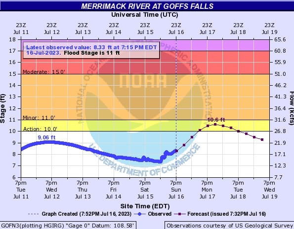
While rain continues to fall in July, the Merrimack River continues to rise. The National Weather Service predicts the river will come within 0.4 inches of minor flooding on Monday night at 8 p.m. The last time the Merrimack crested so high was in 2010 when it reached 11.60 feet in Manchester. Pred


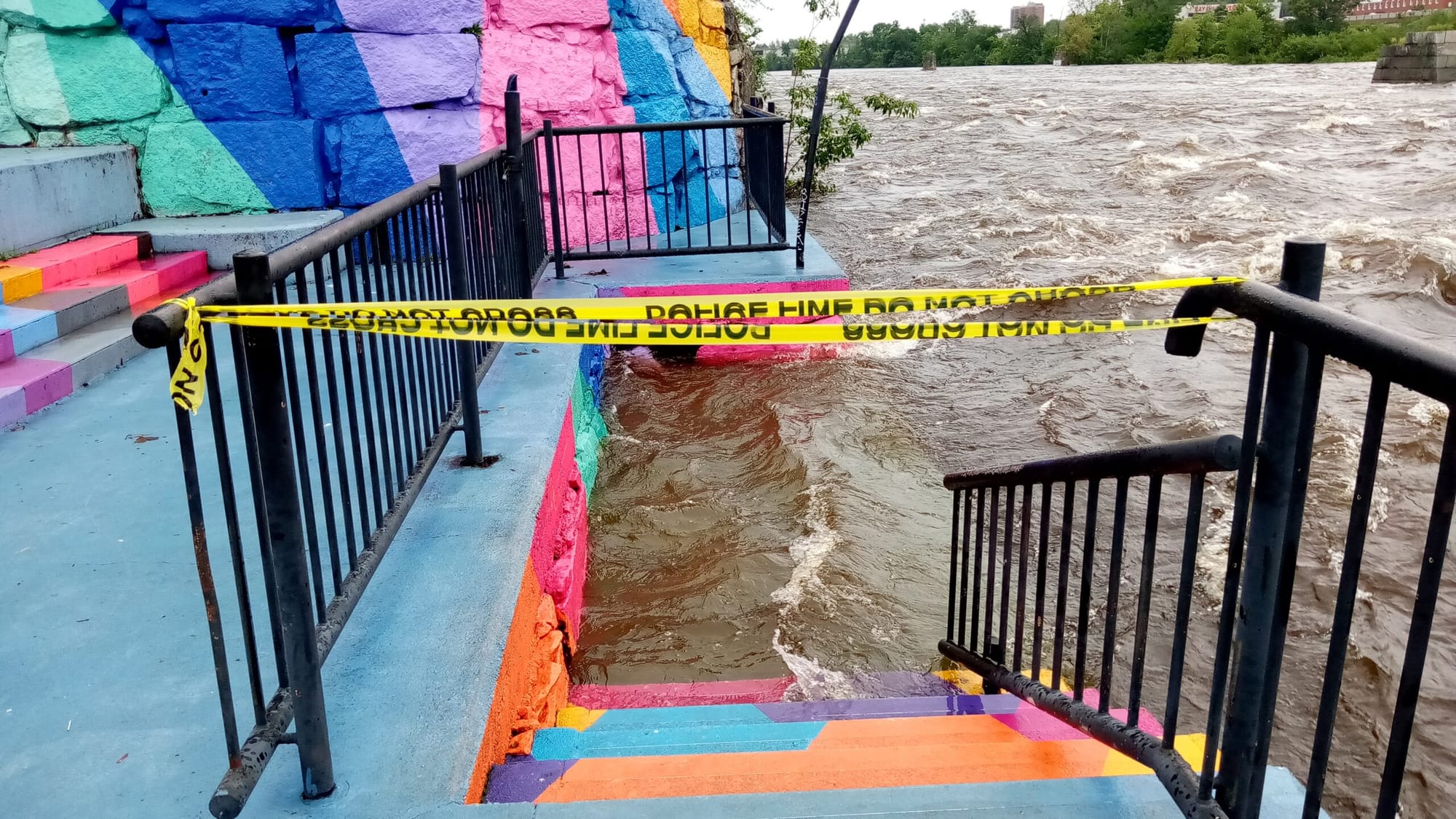

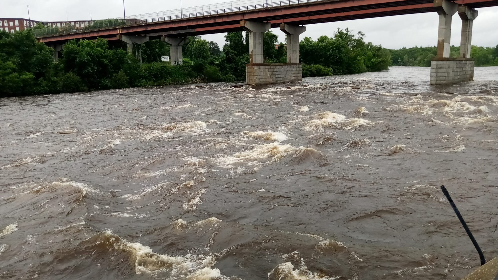
MANCHESTER, NH – The Merrimack River swelled to rarely-seen levels as water lapped up against the stairs Sunday afternoon at Arms Park in Manchester. While 2022 brought drought conditions to New Hampshire, 2023 has brought an unrelenting rainy season. Among the 30 days in June, 22 of them had rain.
While rain continues to fall in July, the Merrimack River continues to rise. The National Weather Service predicts the river will come within 0.4 inches of minor flooding on Monday night at 8 p.m. The last time the Merrimack crested so high was in 2010 when it reached 11.60 feet in Manchester. Predictions so far have the river coming just short of that total.
With rain in the forecast on Tuesday, there’s no telling just how high the river will rise – particularly if another bout of rainstorms comes again. The river, observed at Arms Park, already looks like a choppy, heavy sea, rather than the tranquil, shallow river lapping against various rocks that it usually appears to be.
Flooding in the Monadnock Region and western parts of the state give a clear warning of what can happen when too much rain falls in too short a time: dams burst, roads break down, basements get flooded, rivers rise, and chaos ensues.
In Manchester, flash flooding caused by heavy rains closed down roads, some of which were closed overnight. The east side of Manchester was hit particularly hard, as areas around Hanover Street and Cilley Road were closed.
WMUR reported on a driver rescued by firefighters after his car got stuck in a flooded section of the road. Drivers are urged to avoid flooded roads and to drive slowly through large patches of water to avoid hydroplaning.
In addition, a tornado watch was issued for much of New Hampshire until 3 p.m. Sunday, advising of high winds, possible hail and tornadoes. During the mid-morning, the National Weather Service observed a severe thunderstorm capable of producing tornadoes which could affect Hollis, Amherst, Merrimack, Bedford, Manchester, and South Hooksett.
Tornadoes, while uncommon in New Hampshire, do occur. In 2021, a tornado was observed in the town of Chesterfield.
If the Weather Channel’s long-range forecast holds true, 8 out of the next 14 days will have rain of some description in it. Thunderstorms are expected this week on Tuesday, Thursday, Friday, and Saturday.